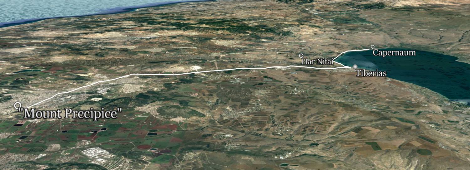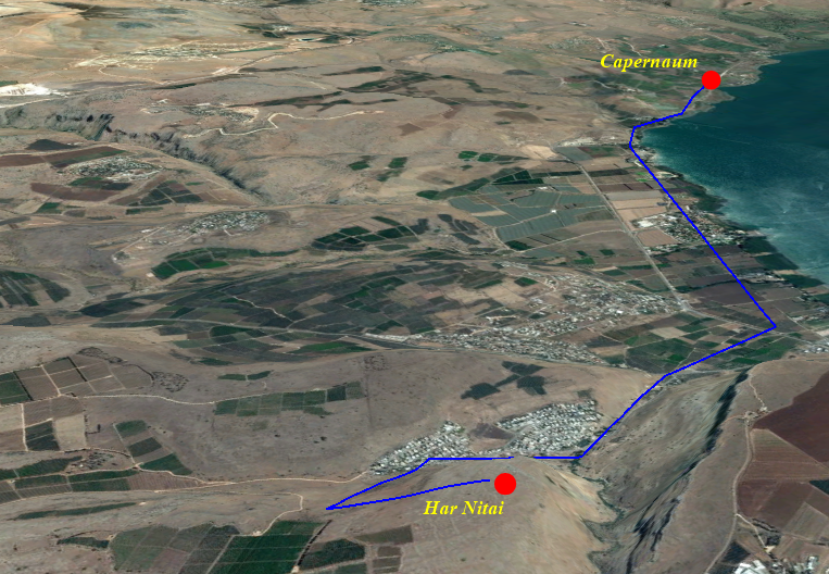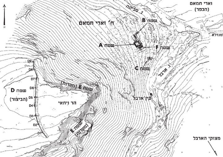
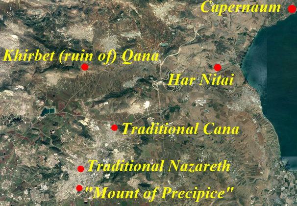
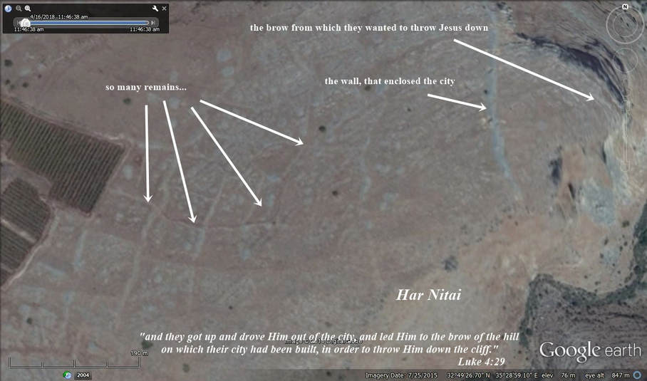
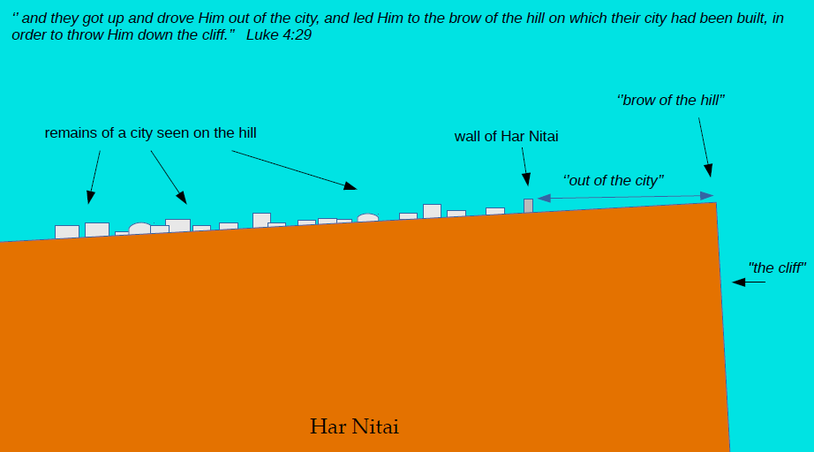
Har Nitai as Nazareth
The whereabouts of Nazareth,
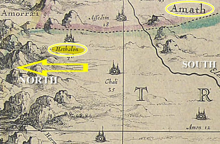
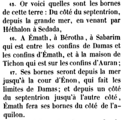
according to Scripture.
Photo Courtesy by Kevin Kluetz
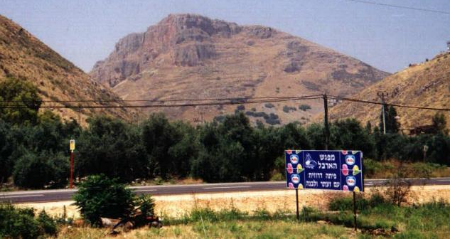
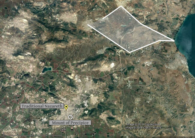
The Mount of Precipice, about a mile (1.5 km) south of the traditional city.
|
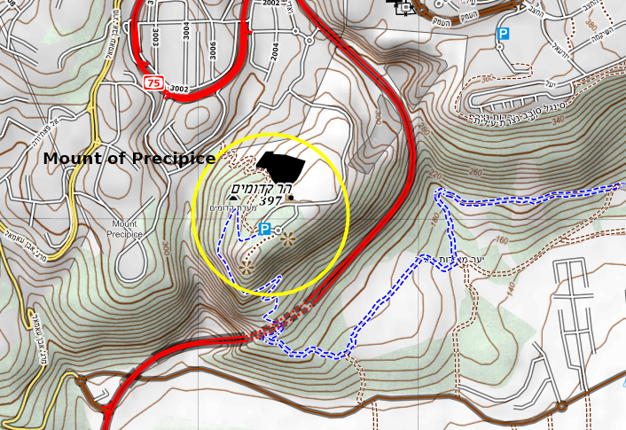
A close-up view with the contour lines where they are closer together.
As it is clearly seen, no contour lines converge which would show the verticality of a cliff (there is an elevation change of 10 meters between the lines). Just a slope. |
K.K.
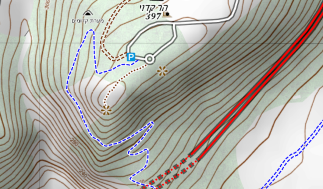
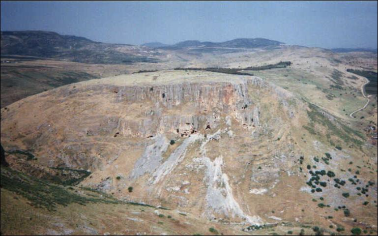
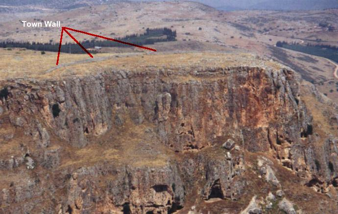
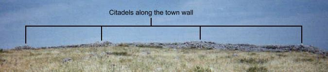
Traditional Nazareth's nearest cliffs. As K. Kluetz states it, they do not qualify as the "brow of the hill on which their city had been built". |
K.K.
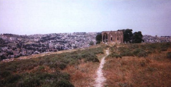
The "Mount of Precipice", with a ruined church. We can see in the background the traditional Nazareth, separated from the hill by a valley. There is not any cliff face at the edge of this hill. |
|
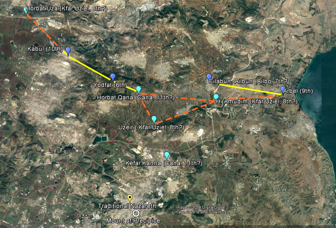
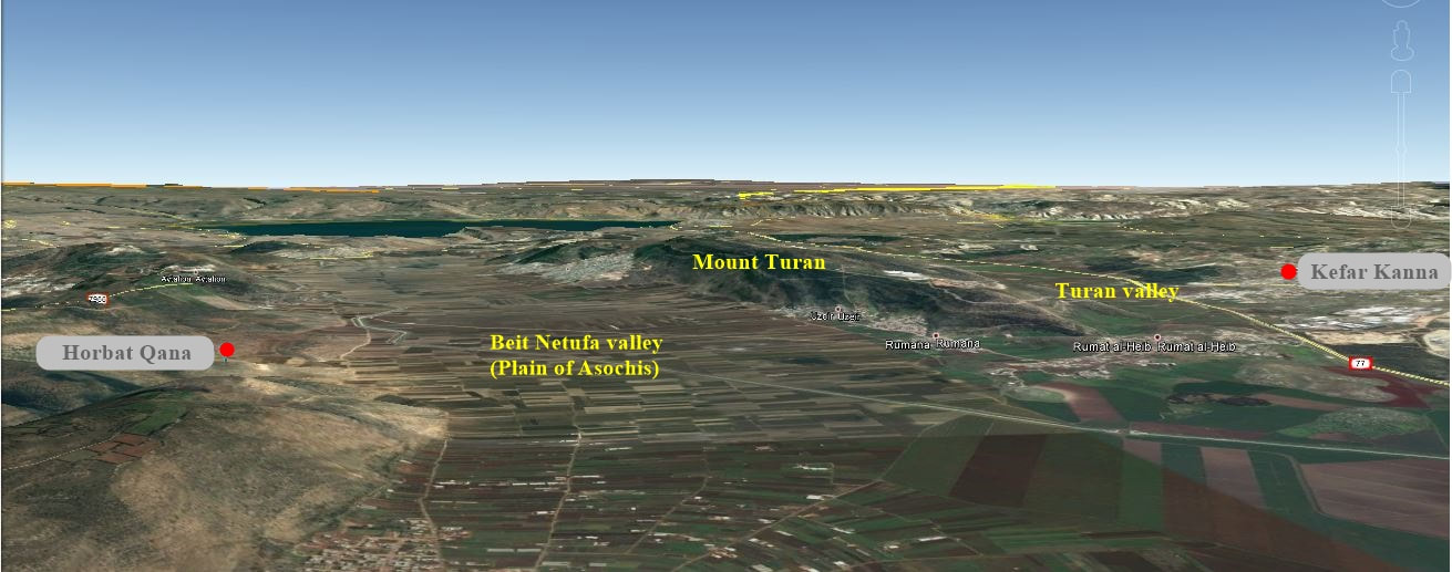
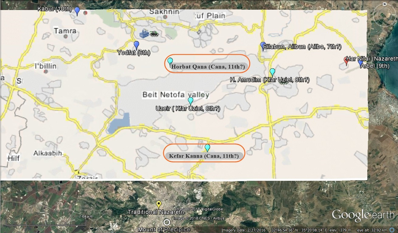
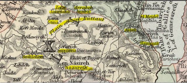
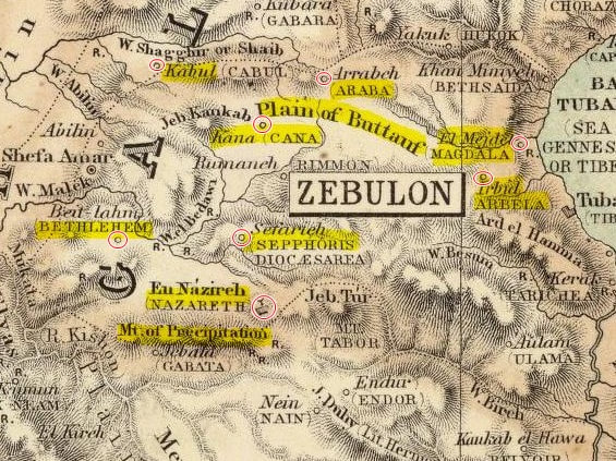
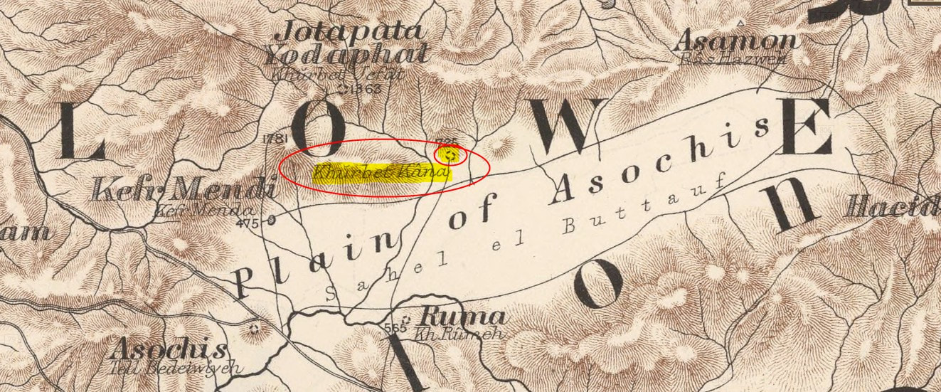
Other maps without the mention of the popular Kefar Kanna close to the traditional Nazareth. Khirbet Qana is called, here, Kana and Cana. |
|
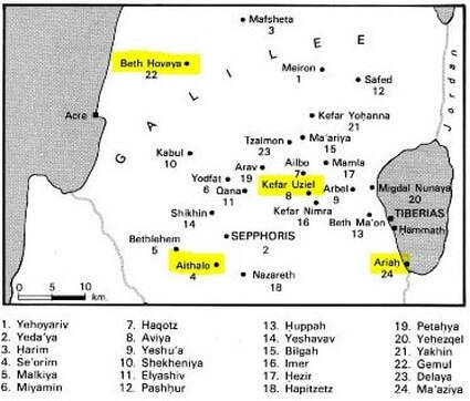
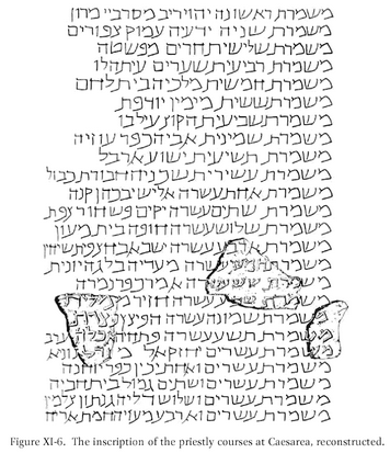
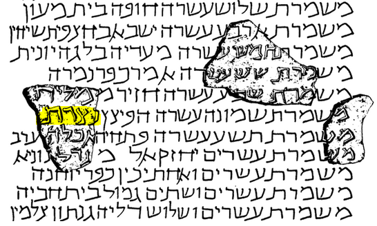
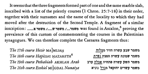
With the list of 24 divisions.
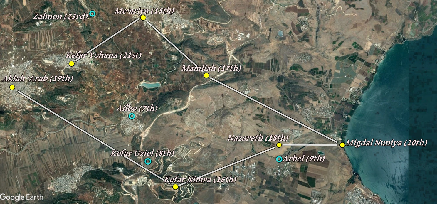
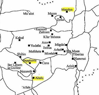
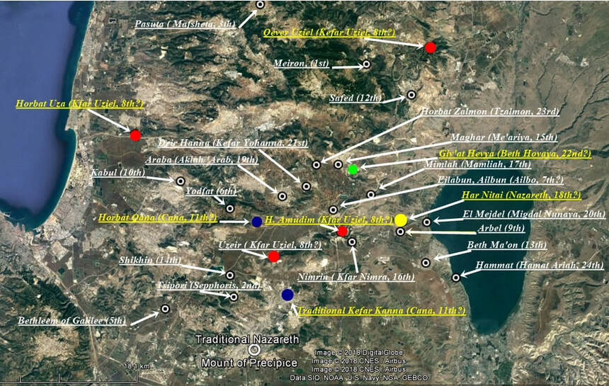
Here the 4th course Aithalo (or Aithalu) is shown in the south of the region, and to the west of the traditional Nazareth; and Beth Hovaya, the 22nd, in the northwest. Kefar Yohanna being the present-day Deir Hanna, it is misplaced here as well. |
Here, Aithalo (Aitalu in the map) is also in the south, but located to the south of the modern Nazareth. Mafsheta, the 3rd course, misplaced, is situated here to the west of the Sea of Galilee when it is situated to the northwest in the other map. Mamla (Mimlah), the 17th, is situated in a different place as well. Kefar Yohanna is correctly placed. |

|
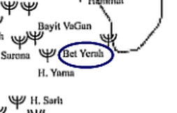
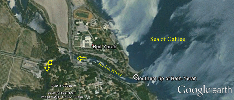
Beth-Yerah, southern end of the Sea of Galilee (close-up of a previous map)
|